
Langfield Common; upper calderdale
The monument in the distance is Studley Pike and beyond that is Erringden Park, one of Earl Warrene’s vaccaries. In 1274 Ricardus del Syk stood surety for Thomas of Langfield who was charged with trespass in the lord’s park. Ricardus was still in these parts, probably cattle farming, in 1309.
A turbulent century
The fourteenth century was turbulent, it started with feudalism at its peak and ended with the system severely dented. A combination of poor harvests and devastating waves of plague, particularly in mid-century, caused a massive reduction in England’s population. Estimates vary, but between one-third and a half of the whole population perished. As a result many areas were desolated and some family lines wiped out completely, labour was in short supply and many estates suffered economic losses. This combination of factors stimulated population movement as manorial lords relaxed the feudal rules restricting movement between manors so as to attract new tenants for lands that had ceased to return a rental income. Unfree tenants had opportunities to obtain better lands or open up new assarts (clearings from the woods and wastes) to expand their holdings. It is not surprising therefore that surnames previously confined to specific locations began to turn up in new places. We shall see in the following section how the Sykes surname distribution reflects this trend.
Our understanding of these movements are aided by one particular set of records that offer a unique national snapshot of surname distribution at this time. Towards the end of the century (1377-79) a series of taxes were imposed upon a reluctant populous culminating in the 1379 Poll Tax, which aimed to tax every household on a sliding scale reflecting their wealth. The poorest households were excused payment but still the Poll Tax was greeted with considerable opposition from the labouring classes and evasion was probably widespread. Estimating its extent is difficult but historians agree the poor are probably under represented in Poll Tax returns. Notwithstanding these limitations the 1379 Poll Tax gives a good indicator of the population spread at that time.
As always with historical records, some returns have not survived or are in part illegible, but notwithstanding these reservations the 1379 Poll Tax provides a core document for assessing population distribution. Yorkshire is fortunate to have a particularly good set of returns that have been transcribed and published. It was compiled township by township so the value to local and family historians is huge.
The following tables include all records so far identified of Sykes in Yorkshire during the fourteenth century. The first table lists all entries found in a diverse range of source documents. Poll Tax entries are identified in separate table.
These combined records of Sykes in the fourteenth century should give a reasonably rounded portrait of their distribution and status across Yorkshire. They should though be considered in the context of population changes and movements descrobed above.
Twenty locations are recorded in the fourteenth century, including Poll Tax entries, but only four of these are continuous with the pre-1300 table:- Langfield/Halifax, Flockton, Fishlake and Almondbury (Parish not the township). We cannot know whether the absentees are lines that withered, moved away to some of the new locations or slumbered on without catching the legal scribes hand.
These sixteen new locations are again scattered across the county, from a single entry at Swaledale in the north to a significant grouping in the broad valley of the River Don along the southern county boundary. A striking new cluster also emerged following the route of the River Aire from its source in the north-western Dales to where it enters the Humber levels in the south-east. There is no obvious connection between these settlements or anything to link them with the core settlements at Almondbury, Flockton, Fishlake and Langfield.
To better understand these background factors please follow the link below for an insight into both Yorkshire geography and Norman power structure. More detail can be found in the references section.
Sykes Records 1300-1400
Excluding 1379 Poll Tax
| Date | Name | Place | Source | Manorial Lordship |
| 1308 | John del Sicke paid annually to Henry Earl of Wakefield 2s 4d | Flockton | YASRS YD5 p58,62 (Clay) | Wakefield (De Warren) |
| 1309 | Ricardus del Sike | Langfield (Halifax) | CRMW v4 p78 & 144-178 | Wakefield |
| 1317 | John of the SIke | Flockton | CRMW v5 p53 | Wakefield & Pontefract |
| 1324 | Richard del Sykis | Halifax | CRMW v5 p38 | Wakefield |
| 1327 | Alano del Syke 12d | Grinton on Swale | YAHSRS Vol 74 Subsidy Roll Edw 111 | De Gant & Bridlington Priory, De Gant links to De Lacy |
| 1357 | Michael del Syke paid highest rent in vill of 2s 4d | Flockton | YAHSRS YD8 p65 (Clay) | Wakefield |
| 1358 | Robert del Syke appt receiver of Manor | Bradford | Bradford Manor Court Rolls Vol 3 (WYAS) | Pontefract |
| 1362 | John & Ralfe de Sike | Bingley | YASRS Vol 52 p85 (Baildon) | Pontefract et al |
| 1378 | Henry del Syke enfeoffed to Robert Jacson and Edmund de Flokton for land named Eddyngrode | Later 1406 deed shows this land was adjacent to Jacson’s in Emley | YASRS YD8 p66 (Clay) | Wakefield & Pontefract |
| 1385 | Johannes del Syk, taillour | York | Register of Freemen of City of York Vol1 p81 (CollinsMD225 | |
| 1386 | John by the Syk | Holme | MD225 | Wakefield |
| 1387 | Thomas de Syke, tapiter | York | RFCY Vol1 p82 | |
| 1391 | Thomas del Syke junior, tapiter | York | RFCY Vol1 p89 | |
| 1400 | John del Syke | Ingbirchworth | FoF CP 25/1/279/152 No3 | Pontefract |
1379 Poll Tax
| Wapentake | Parish | Township | Lordship | Abbey | Taxpayer | /d |
| Staincliffe | Giggleswick | Langclyf | Percy | Sawley | Patrick Sykes | iiii |
| Staincliffe | Slaidburn | Newton in Bowland | Pontefract | Ricahrd de Sykes & wife | iiii | |
| Skyrack | Otley | Baildon | Pontefract | Rievaulx | John del Syke & wife | iiii |
| Skyrack | Guiseley | Horsforth | The King | Kirkstall | Robert del Syke & wife | iiii |
| Morley | Bradford | Bradford | Pontefract | Kirkstall | Robert del Syke & wife | iiii |
| Morley | Bingley | Bingley | multiple | Rievaulx | John del Syke & wife | iiii |
| Morley | Bingley | Bingley | multiple | Rievaulx | Agnes del Syke | iiii |
| Agbrigg | Huddersfield | Quick | Pontefract | Roche | Adam del Syke & wife | iiii |
| Agbrigg | Quick | Hogerus del Syke & wife | iiii | |||
| Agbrigg | Kirkburton | Emley | Wakefield (sub Fitzwilliam) | Byland | Henry & Alice del Syke | iiii |
| Osgoldcross | Fishlake | Fishlake | Conisbrough / Crown | Lewes | William de Syke & Johanna, wife Walker | vi |
| Osgoldcross | Snaith | Pollington | Pontefract | York & Selby | Robert at Syke & Beatrix, wife | iiii |
| Strafforth | Darfield | Great Houghton | De Busli | Wm de SIkeston & Alice, wife | iiii | |
| Tickhill | Stainton | Staynton | Duke of Lancaster | Wm de Wilsike & Joanna, wife walker | vi | |
| Tickhill | Thorne | Thorne | Conisbrough | Robert de Wylsewyke & Agnes | iiii |
Analysis of C14 Sykes Settlements
Only four of the pre-1300 Sykes locations maintained a presence into the fourteenth century, all of which were in the West Riding of Yorkshire. Sixteen new locations were documented for the first time but these further consolidated the West Yorkshire concentration as all bar three were in the West Riding. We cannot know whether Sykes had been resident, but not left prior records, in any of those places making a first appearance. However all except one (Grinton-on-Swale) were first recorded after 1350. Given the context of increased population movements in the post plague years of the latter half of this century, it would be reasonable to assume many Sykes had moved manors in the dynamic restructuring that accompanied labour shortages and selective relaxation of some feudal obligations. Half of the new entries were adjacent to, or associated with, an existing cluster and most of the remainder formed a striking new linear pattern that may be considered as a separate cluster in its own right.
In summary, there are no new entries in the fourteenth century that threaten the primary core cluster of mid-Yorkshire for consideration as a single or main source of the surname, however some of the new entries, by virtue of their proximity to pre-existing clusters, potentially consolidate that theory. The groupings are described and analysed below. Maps x&y should aid understanding of the distribution pattern.
The Core Cluster
The Core Cluster of Sykes settlements were consolidated in the corridor between Flockton and Almondbury parish, which runs west to east for approximately fifteen miles, from the summit ridge of the Pennines to the lowlands near Wakefield and is almost entirely contained within the Wapentake of Agbrigg. This corridor contains four of the new entrants, Quick, Holme, Ingbirchworth and Emley as well as the continuing entries in Flockton, Upper Calderdale and Almondbury.
Quick township was one of four “meres” (boundary areas) in Saddleworth, but its name was often used as a shorthand for the whole of Saddleworth. This appears to have been the case with the 1379 Poll Tax as no returns are listed for the other three meres. Saddleworth as a whole formed the western most part of De Lacy’s Honour of Pontefract and administratively came within Almondbury manor and parish. The intricate history of Saddleworth/Quick is too complex to summarise here, other than saying it covers a spectacular piece of landscape straddling the Pennine summit ridge where the old borders of Yorkshire, Lancashire and Cheshire met. It was strategically important to the De Lacy lordship as it joined up to their Lancashire estates (held under the Honour of Clitheroe) and their Cheshire estates (held under the Barony of Halton). Saddleworth also guarded three important cross-Pennine routes (Longendale, Greenfield and Austerlands) the latter of which an important military and trade route since at least Roman times.
There is no evidence of significant early industry or commerce in Saddleworth. The upland commons were unenclosed expanses of rough grazing managed primarily as hunting forest and livestock grazing. The livelihoods of its residents would have echoed those needs. Adam and Hugh del Syke with their wives were recorded in Quick at the 1379 Poll Tax. We know their occupations or whether these two separate households represent two successive generations, but the existence of two parallel households appears to suggest a relatively stable settlement rather than just a transient stopping off point.
From the Yorkshire side one of the most prominent features of this landscape is Wessenden (West end) Head, a shapely gritstone escarpment where the rivers Holme and Colne rise respectively on its south and north sides, before flowing down in parallel valleys, through the foothills to join the River Calder east of Huddersfield. Both Almondbury manor and Almondbury parish followed the south bank of the Colne for ten miles from its source on the summit ridge to its junction with the River Holme (just to add confusion both rivers were known as the Colne in this period!). These three places, Quick, Holme and Almondbury shared a common landscape and economy and probably to some degree, common personnel. From a very early date the upper reaches of Saddleworth were operated as a vaccary (cattle ranch) and hunting forest under the manorial lordship of De Lacy’s. Between 1177-80 they granted this manor to a mesne tenant, Roger de Stapleton of Darrington, along with a significant part of the upper Colne Valley, including Slaithwaite. Stapleton subsequently granted a lease to the Prior of St Oswald’s of Nostell to run 240 sheep and 40 cows “in the common pasture of Sadelwrth“. Similar grants were made in other upland townships under De Lacy control, including Marchedene (Marsden) at the head of Colne Valley which was contiguous with Saddleworth:
1177-93 grants by Robert de Lascy “to the monks of Fountains of pasture in the forest of Marsden for 40 cows and their off-spring of 2 years, 30 oxen and hay for their support in winter”
We have no other early records for Sykes in either Quick or Marsden, but we do know that by 1400-25 William Sykes held a vaccary tenancy at Wessenden in Marsden. Although this is the first mention of William we do not know whether it was his first arrival on the scene. It is quite feasible William of Wessenden descended from the Quick line and continued a family tradition of upland vaccary farming which subsequently colonised the Colne valley. This is speculation but it may help explain why no further records have been found of Sykes in Quick.
We can speculate further that Sykes in Quick may have been descendants of another early Sykes, Ricardus del Sike, resident of Langfield 1274-1309. The landscape and economy of Langfield in the upper Calder valley was very similar to that of upper Colne and Saddleworth, it too was farmed as hunting forest and vaccaries, but in this case the different lordship of Earl Warrene. Sykes were not recorded in the Calder valley after 1326 so it is perfectly feasible they too chased the money and moved twelve miles south into a new opportunity, with a different landlord, but doing essentially the same type of work. As yet we have no proof of such a link.
The Holme Valley mirrors the Colne, its northern neighbour. Holme too stretched from the Wessenden/Saddleworth summit ridge down a river valley and into the foothills. Administratively it was a collection of seven small settlements known as the graveship of Holme, part of Earl Warrene’s huge Manor of Wakefield. In area and characteristics it mirrored Almondbury manor. The uppermost area lying underneath the summit ridge was Austonley township which itself contained a number of small hamlets or “booths”. Topographically this area echoed other Pennine uplands in providing broad expanses of rough, wet grazing suitable for little other than stock rearing and hunting. Sykes were recorded in the Wakefield Manor Rolls as taking a number of assarts in Austonley, Holmewood, Cartworth and Yateholme from 1386 before settling at Hoowood, all of which are located around the head of the valley, just below the summit ridge. This timing fits neatly within the national context of migration and explains why Sykes were not recorded here in the 1379 Poll Tax. The court roll entries are mainly seeking licences to graze but also include a few charges of trespass or taking timber from the lord’s wood. Sykes were clearly subsistence farming, no trades are mentioned. They were to remain here for almost exactly a century and appear to have had two or three family units operating at anyone time.
Redmonds published works promoted a theory that Sykes came to Holme from Flockton, but given the context described above a more probable route would have been to come over the watershed from Quick, which shared a common boundary with Holme. This makes more economic sense too, it is difficult to imagine why an established successful family in the prosperous territory of Flockton would uproot to the hostile wastes of the upper Holme valley, especially when there was land-a-plenty standing vacant in adjacent townships. Latterly in his unpublished notes Redmonds acknowledged the viability of this alternative to his previous position.
Looking at the overall context of Quick, Holme and Marsden it is difficult to see anything but an homogenous community on these uplands, sharing a landscape, a common economy and probably common genes.
Ingbirchworth village lies south-east of Holme and seven miles west of Flockton. It may have been a stepping stone between the two but there is no long term Sykes residency in the village. The land occupied by John del Syke was tenanted from the vicar of Halifax, an unusual owner in these parts, but one which offer an intriguing potential link back to Langfield, which came within Halifax parish. We know nothing more of this family, save to say John was a common name in both Flockton and Holme, either of which could have been the root of Ingbirchworth Sykes.
Emley is contiguous to Flockton, the two townships being separated by a shared common, which featured prominently in the Flockton Sykes story. This core axis will all be dealt with more thoroughly in a following section. Emley continued to be a substantial Sykes settlement into the seventeenth century.
The Southern Boundary Townships
Fishlake is in the south-east corner of the West Riding, fifty miles from the Pennines and in a completely different landscape. On the banks of the navigable River Don it straddles the sea level marshes in an area where the rivers Don, Ouse and Trent meet to form the Humber levels. In this low lying area we also find Pollington (Snaith) and Thorne. The latter was in Tickhill wapentake, as was Staynton a few miles to the west. This cluster of four settlements are isolated from the core group by some fifty miles, without any geographical connection. Admistratively Fishlake and Thorne initially fell within Earl Warrene’s great fee of Conisborough, but by the mid-fourteenth century Warrene’s estate had been subsumed by the Duke of Lancaster and thereafter was held directly by the crown. De Lacy’s Honour of Pontefract held Snaith and Thorne, important ferry points for crossing the Humber and thus providing a direct link between their Yorkshire properties and their extensive Lincolnshire estates, held as the Earl of Lincoln. These settlements were therefore strategically important and their respective lordships would have a guaranteed demand for labour and services.
It is probably significant that in this cluster the surname has morphed somewhat differently giving variations on the simple “Syke” formulation; “Wilsike” (Staynton) and “Wylsewyke” (Thorne) could easily have been formed from the juxtaposition of the given name “Wil” in front of “Sike”, perhaps as a relationship indicator. A minor place name “Wilsike” is recorded a few miles north of Tickhill, we have no indication whether the surname or place-name came first. However both locations, but particularly Thorne, are geographically related to the Fishlake cluster, along Yorkshire’s southern boundary which gives reasonable grounds for considering them in that context. By the emergence of parish registers in the mid-sixteenth century Sykes are noted in these and several other townships in this southern boundary area.
Great Houghton in the Dearne Valley is an anomaly that forms no part of any known cluster. It lies between the Agbrigg core and the southern boundary cluster. Although this is a lone cluster we shall see that by the sixteenthr century a significant Sykes branch had developed in the Dearne Valley, but we have as yet no links between them and this early entry. The name recorded here is “Sikeston“, which clearly has a common first element but this surname variant was not recorded elsewhere. It is included here for completeness but it may be a corruption or mistaken entry for the South Yorkshire parish of Silkstone.
Northern Outliers
Grinton-on-Swale, at the northern end of the county, is literally miles away from any other Sykes locations and does not belong to any Sykes cluster. It appears just this once as a Sykes residence, but Grinton has tentative connection to several other Sykes location through its manorial lordship. Conan, Earl of Richmond, granted the manor of West Grinton in Swaledale to Alured de Gaunt around 1170. De Gant were sub-tenants to De Lacy in several locations where Sykes were also found,including Bingley, which is considered below . One of the witnesses to the 1170 charter was Gilbert Foliot whose family were also under-lords to de Lacy in several West Riding townships around Doncaster. In a charter of 1237 Richard Foliot confirmed his father’s grant of lands (including the men and their families) in Fishlake to the monks of Nun Appleton. These connections may appear tentative, but this was an era when bondsmen where bound to the soil of their manor and could only legally move out of that manor with the agreement (or direction) of their lords. It is not impossible therefore that a “useful” villien may have been either offered opportunities or forcibly transferred elsewhere within a “fee” to meet the lord’s need. These manorial connections could therefore explain how and why Sykes moved between specific geographical locations, including from West Yorkshire to North Yorkshire .
York was the leading administrative and commercial centre in the north, and as a regional capital drew entrepreneurial migrants from all parts, including the continent. In the early fourteenth century expanding markets for woven goods were particularly attractive and geographically accessible to West Riding farmer-weavers. The York Guilds were sufficiently concerned about this influx they passed restrictive bye-laws to vigorously protect their respective trades against incoming usurpers, whom the Guilds considered to be low skilled. “Tapiter” was a relatively new trade making coverlets (for beds) and wall hangings for the newly rich merchants who were keen to display their success. This previously unregulated market was one of the few trades where the West Riding weavers could gain a foothold. We have no evidence of Johanne and Thomas’s origins, but it is feasible they had a West Riding background. Sykes continued to be recorded in York in small numbers over the next two hundred years and are mentioned in early parish registers of that city, but there is no evidence a large population of Sykes ever developed there. It is possible however the tapiters were related to some of the Sykes that appear south of York in the subsequent centuries.
Airedale, the long cluster
Airedale: The remaining seven locations form a remarkable geographic and administrative pattern. Beginning on Yorkshire’s southern border with Lincolnshire at Pollington in the parish of Snaith, it passes through Horsforth, Baildon, Bradford and Bingley, before winding through the “Aire Gap” to Langcliffe and finally flipping over the watershed to Newton-in-Bowland close to the Lancashire border. This pattern effectively traverses the whole of West Riding of Yorkshire by following the course of the River Aire from its source in the Yorkshire Dales to its outflow into the tidal River Humber. The correlation is striking, Sykes settlements are spaced out along the route in a pattern resembling service stations or garrisons on a well trodden route, laid out with a purpose rather than the random scattering of unrelated places. Five of the seven townships were within the common lordship of De Lacy’s, four in their Honour of Pontefract and one, Bowland, in their Honour of Clitheroe. Pollington/Snaith provided a safe ferry crossing across the Humber levels into Lincolnshire and another De Lacy seat of power, Lincoln Castle, where they held the Earldom of Lincoln. This whole route was regularly travelled by the De Lacy entourage as they moved between their regional seats of power at Lincoln, Pontefract and Clitheroe Castles. One account suggests they could travel virtually the whole 115 miles from Lincoln to Clitheroe without leaving their own lands. This is probably apocryphal but does indicate the economic power and extent of De Lacy’s status. The journey, on horseback with a sizeable caravan, would have required two or three overnight stops in safe places and probably other stops for rest and refuelling. The distribution of Sykes settlements suggests they were part of this support network and the De Lacy proposition provides a rational explanation for this striking new settlement pattern. Its emergence in the late fourteenth century would also be consistent with what we know of population dynamics at this post plague time. It seems likely the highly organised De Lacy administration encouraged, enabled or enforced Sykes individuals to migrate from their traditional settlements into these strategically important places.
Bradford was granted a market charter c.1350 which reflected its role in the local economy. It’s significance to De Lacy was due entirely to the coincidence of its location, half-way between Pontefract and Clitheroe and a decent day’s ride from both. It was also on the outskirts of the Forest of Trawden, one of the Earl’s hunting forests occupying a large portion of the upland landscape between Bradford and Clitheroe. Fortunately we have a detailed description of how the De Lacy entourage impacted Bradford as it prepared for two days of feasting, celebrating and servicing their lordship. hyperlink Bradford. Bradford manor court records of the time show that in addition to the normal manorial office holders such as constable, pinder and jurors Bradford manor had some specifically dedicated to serving the lord’s entourage on its processions through town, these included horn-blowers (to herald the arrival of his lordship) and huntsmen, whose duties included accompanying the lord for forty days and forty nights whilst he hunted in Trawden. Another key role was that of Receiver of Bradford, a role both practical and ceremonial that required its holder to collect rents and taxes due to the lord and deliver them to the lord’s treasurer at Pontefract. Robert Sykes served as receiver in 1358. We might presume the office holder would be a trusted and established resident but some commentators have suggested that during this period trusted new blood was deliberately brought into declining areas from outside and given positions of responsibility to act as exemplars to the natives . Such a scenario could be consistent with Sykes individuals first recorded appearances in the Airedale communities.
Bingley township was granted a market charter in 1212, almost forty years before Bradford gained the same status, which suggests it had already become a local economic centre. It appears to have served both the local area and travellers using the Aire Gap route between West Yorkshire and the north-west. A 1362 deed on behalf of the Passelewe family lists lands belonging to a large estate (greater than ten carucates) containing land parcels in Bingley, Keighley and thirteen smaller townships mainly in this portion of Airedale. John del Sike and Ralph del Sike were amongst twenty-three individuals named as owing homage and service to the Passelewes. We know not the status of any of these individuals although the list included one knight. By the 1379 Poll Tax, John del Syke and his wife were still present but Ralph had been replaced by Agnes del Syke. Agnes is not identified as a widow but it is possible she was the relic of Ralph. Both were paying tax at the basic rate.
The manorial titles for Bingley are complex as it comprised of several smaller manors divided between various members of the Yorkshire nobility. The lands were largely let to mesne under lords, one of the most prominent of which was the de Birkin-Everingham family who featured prominently in several other manors where Sykes were recorded, including Nottinghamshire. This connection is explored elsewhere. We have no further Sykes entries for Bingley beyond this date.
Baildon and Horsforth both record Sykes residents for the first and last times in the 1379 Poll Tax returns. Although there is no long term record of Sykes in these two townships it is possible they moved just a short distance into the neighbouring parish of Otley where early sixteenth century records show Sykes were already established residents.
Langcliffe township, in the manor and parish of Giggleswick, is actually in Ribblesdale, but situated just a few miles west of Malham where the River Aire rises. It’s relationship, if any, to the other Airedale entries is not clear. Post-conquest the manor was granted to the Percy family of Topcliffe who sub-infeuded it to Elias of Giggleswick. In 1240 Elias granted the whole of Langcliffe to Sawley Abbey where it remained as a grange or upland farm until the dissolution.. Craven Heritage Trust (Lord, 2009) have undertaken a detailed study of farming in this area which definitively puts Langcliffe in the same pastoral farming economy as those other upland settlements where we find Sykes. Perhaps this occupational link explains why Patrick Sykes paid Poll Tax here in 1379. Patrick is an uncommon name at this time and possibly reflects the religious influence upon the township’s tenants. The partial extant Giggleswick Manor Court Rolls record a Johe de Sikes as resident in 1420 and 1421, but no further Sykes are known to have been here after that time.
Newton in Bowland in the manor of Slaidburn was at the heart of De Lacy’s extensive hunting park in the Forest of Bowland and formed part of their Honour of Clitheroe. Geologically Bowland’s landscape profile is similar that already noted in other upland Pennine areas such as Langfield, Holme and Trawden – gritstone moorland plateaus cut by deep river valleys where scattered settlements served the lord’s dual purpose, catering for the leisure interest of hunting parties at certain points in the calendar, combined with seasonally managed vaccaries providing meat, milk and income. Initially Bowland was administratively within Yorkshire until the 1974 re-organisation when it was transferred to Lancashire, but its border location clearly demonstrates its value to De Lacy, both as a strategic defensive site and a functional bridge between their Yorkshire and Lancashire territories. Although Sykes do not appear to have sustained much presence on the Yorkshire side of Bowland the majority of early Sykes records in Lancashire were in places within the Honour of Clitheroe, especially around the edges of Bowland. It seems logical to assume the Sykes families found here had a common origin linked to their Yorkshire cousins by the De Lacy estates. We have no evidence to show whether they were forcibly located here or simply took advantage of entrepreneurial opportunities, perhaps following the Black Death.
Cheshire and Derbyshire. There are currently no known records of Sykes in Cheshire and Derbyshire pre-1500, but circumstantial evidence and political context suggests that contemporary with Sykes being recorded in Bowland it is likely a small number of Sykes families also resided in the Longendale valley which runs across the northern boundaries of Derbyshire and Cheshire. The evidence for this is considered below but the rationale is consistent. In the fourteenth century Sykes are frequently recorded at significant points in the De Lacy empire. Longendale was one of De Lacy’s strategic routes so the likelihood of Sykes serving De Lacy in these parts is at least credible. We have noted above how the De Lacy caravan toured across country visiting its major strategic holdings, from Lincoln to Pontefract then Clitheroe. They developed well defined routes, maximising as much as possible the relative security of travelling though their own estates in the often troubled times of fourteenth and fifteenth century England. This principle was also applied on the other side of the Pennines. De Lacy held substantial lands in Cheshire and the prestigious title of Constable of Chester, effectively another Earldom. After leaving Clitheroe and Bowland they could travel south to their Cheshire estates almost without leaving their own extensive lands in Blackburnshire and Rochdale, both of which towns were at the centre of wider civil and ecclesiastical administrative areas. At its south-eastern end Rochdale bordered the Yorkshire township of Quick in Almondbury parish, another De Lacy stronghold. From here a natural gap between Pennine summit plateaus carried an ancient pass along Longendale thus completing the loup eastwards back into Yorkshire. Longendale (better known today as the Woodhead Pass) had been an important trading route since salt was first mined in Cheshire in the pre-Roman era. Its financial importance to the lord’s of Cheshire was consolidated when the administrative county boundary of Cheshire was drawn to extend a long finger up the Longendale valley, protecting the valuable Cheshire salt trade. This route skirted Derbyshire to the south and Yorkshire to the north (see Map x) and Photograph below). It was therefore a strategically important route for De Lacy’s who controlled much of the land at either end of the pass. As with the Sykes of Bowland, it is probably no coincidence that the earliest Sykes records in south Lancashire, Cheshire and Derbyshire are found in the vicinity of the Longendale, ie Rochdale, Mottram and Glossop.

Longendale and the Woodhead Pass looking from the west (Lancashire & Cheshire) to east (Derbyshire & Yorkshire). Quick township occupied extensive territory on the northern side of the valley. The County boundary of Cheshire extended up this valley like a long finger. Today the valley carries the A628 trunk road between Manchester and Barnsley/Sheffield plus a chain of reservoirs supplying Manchester. Torside Clough is the prominent cleft running from top right to centre of the picture. Torside farm stood at the bottom of the clough near where the reservoir shore is now exposed. It was occupied by John Sike and his descendants from before 1563.
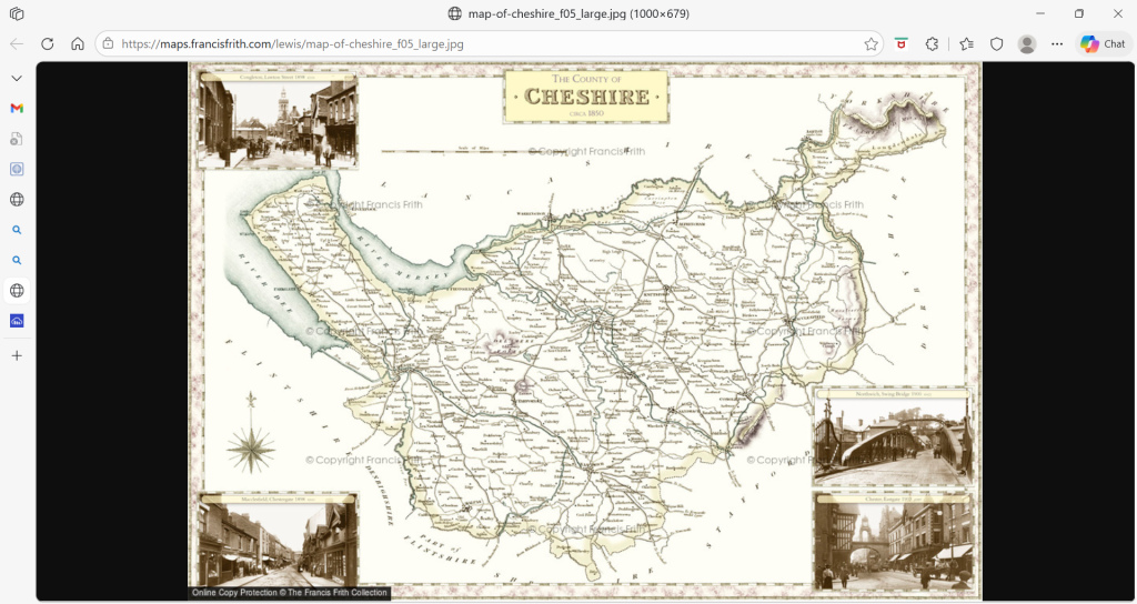
Map of the pre-1974 County of Cheshire. The prominent finger poking out top right is Longendale.
The first reference to a Sykes connection with Longendale comes ironically from the Wakefield Manor Court. In 1476 a group of armed men from Longendale entered the Holme Valley and stole sheep which they drove away. Court scribes did not record the background to this raid but Redmond’s analysis of the event is compelling1. He pointed out that many of the accused Longendale men had names associated with Holme Valley, including Thomas and John Sykes. Redmonds concluded these raiders were retaliating for having previously been driven out of the Holme Valley in a territorial dispute, quite probably related to the recent Wars of the Roses during which Warrens (manorial lords of Holme) and De Lacy’s lined up on opposite sides. Redmonds believes this to be the probable cause of Sykes abandoning the Holme Valley and escaping to Slaithwaite. This is of course speculation, even if credible. Redmonds does not consider the possibility that some Sykes were already present in Longendale and played host to the outlaws, but the two scenarios are entirely compatible.
There are just ten Sykes entries in the pre-1600 Derbyshire parish registers, mainly located in Longendale and the village of Holmesfield, south of Sheffield. The earliest definitive record yet identified is from 1563 when Nicholas Sykes, a 72 years old husbandman of Mottram (Cheshire) gave evidence in a tithe dispute2. Nicholas’s evidence was highly valued because of his longevity and heritage knowledge. If Nicholas had been born in the valley 72 years earlier that places a Sykes family in Longendale in the 1490’s. Parish registers record Nicholas’s burial in 1570. This is almost certainly the same Nicholas Sykes who made his will on 18th February 1567 at Thorsyde, Glossop, three years prior to his death in April 1570. Thorsyde was an isolated farmhouse (now site of the Peak Park’s Torside Vistitor Centre) in the Longendale Valley, just about five miles from the Yorkshire boundary. Nicholas’s probate inventory shows him to be a comfortably-off hill farmer running 140 ewes and and 166 followers (lambs for breeding and slaughter) together with around a dozen cattle and a horse. He left his goods to be split between his five sons with the unusual stipulation “all my childeren shallbe kepte of my whole ferme together“. Subsequent parish records confirm the Sykes family continued to farm in this area through the seventeenth century.
- George Redmonds unpublished notes posthumously catalogued by Huddersfield & District Family History Society. ↩︎
- Mottram Tithe case – Cause Papers ↩︎
THE WILL

Extract from the Inventory of John Sykes of Torside, Glossop, 1570.